

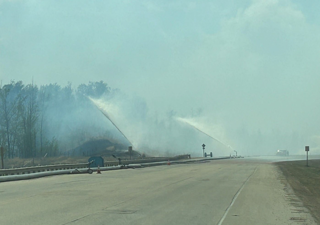
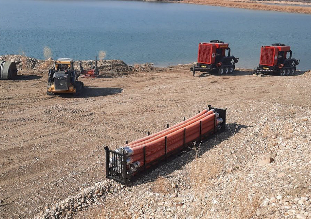
Executive Summary
This case study provides an anecdotal description of a wildfire incident that impacted Brazeau County and the town of Drayton Valley in Alberta, Canada. The Buck Creek Wildfire was part of a very significant 2023 wildfire season that affected British Columbia, Alberta, and the Northwest Territories in Western Canada. The wildfire demonstrated extreme fire behaviour driven by drought conditions and foliar moisture conditions unique to the early and dry spring.
The Fire & Flood team played an important role in protecting the town and other structure values early in the incident. During latter parts of the incident the team demonstrated the flexibilities in their systems as well as the ability to contribute to direct attack. The incident clearly demonstrated that the company has the following capabilities:
- Rapid self-contained response,
- Ability to operate with limited Command or fire behaviour specialist support,
- Responsiveness to changing demands,
- Ability to effectively provide progressive wildfire extinguishment.
The most significant observation from this case study was the ability of the Fire & Flood system to contribute to direct attack. In conditions of low fuel moisture in fuel beds that can carry deep relatively continuous ground fire, the systems have good utility for progressive attack from the perimeter. This operation commonly referred to as mop up can be very time consuming for personnel and carries significant risk factors. The Fire & Flood systems can complete this work more efficiently and with lower risk for personnel.
Introduction
This case study provides a description of a rapid incident response provided by Fire & Flood Emergency Services Ltd to the Buck Creek (RR64) Wildfire that affected the town of Drayton Valley, Alberta from May 5 – May 14, 2023. The case study showcases several aspects of Fire & Flood’s response capabilities deployed on a challenging incident. The study relies on interviews, images, and on-site documentation.
Location
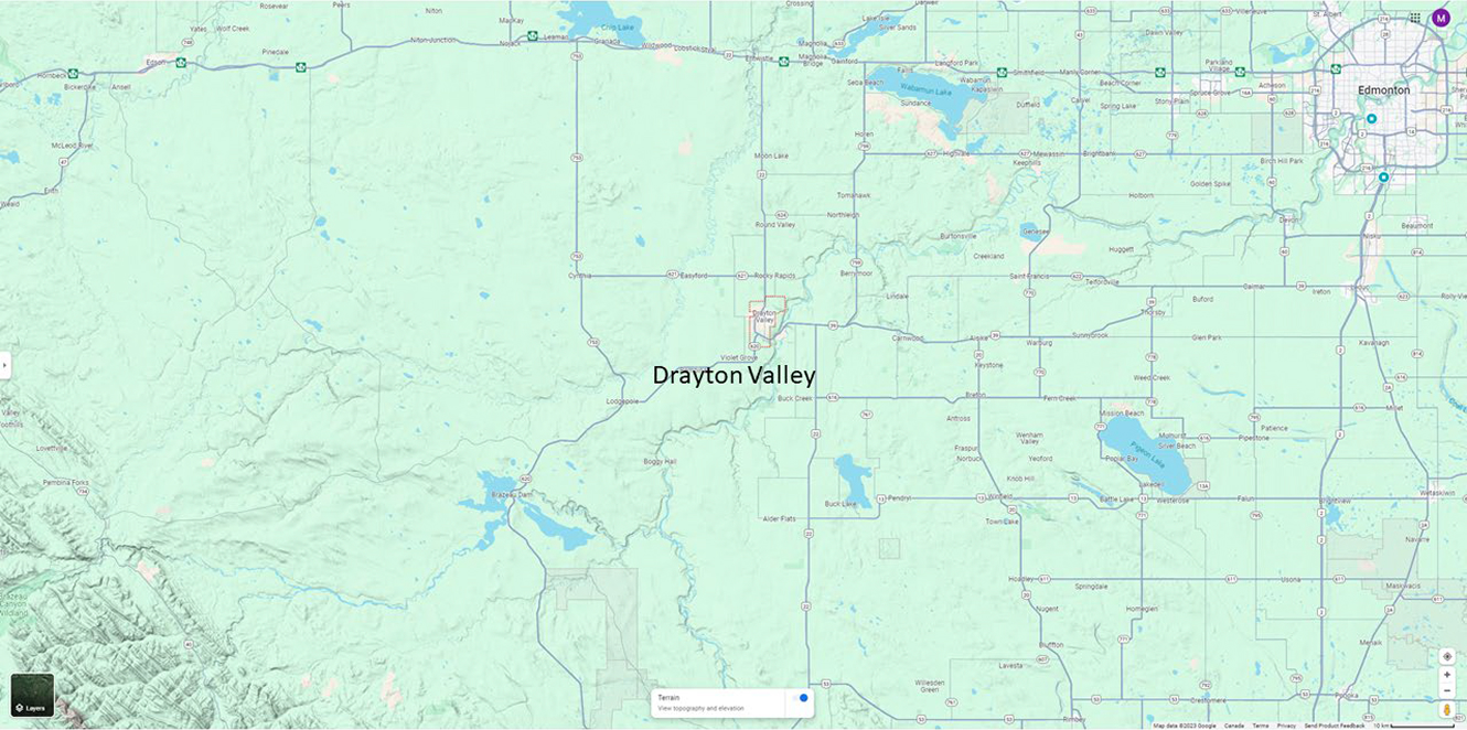
The town of Drayton Valley is in the southwest part of Alberta, 140 kilometers east of the city of Edmonton. The town is bounded by the North Saskatchewan River to the North and Highway 22 to the south (Figure 1).
2023 Wildfire Seasonal Overview
Regional Fire Weather Overview
During the 2023 wildfire season Alberta and much of Western Canada was experiencing a significant drought. Figure 3 shows that the area around Drayton Valley was significantly impacted by a multi-year drought on April 31, 2023.

On May 4, 2023, the Canadian Forest Fire Danger Rating System (CFFDRS) Fire Weather Index (FWI) for Drayton Valley was extreme (Figure 3). The FWI is an index of the potential for extreme wildfire behaviour incorporating rates of spread, intensity, and severity of a wildfire.
In addition to the extreme overall wildfire danger, the long-term drought and below normal spring precipitation had contributed to an extreme Drought Code of over 425. The Drought Code is an index of the amount of large forest fuels and deep organic soil layers that are available to burn. With Drought Codes over 425, wildfire managers can expect all fuels to be involved and for a potential wildfire to burn deeply into organic soils.
The forest fuels south of Drayton Valley were composed of a mix of conifer and deciduous trees with areas of pure Aspen and grass stands immediately south of Highway 22. Normally deciduous fuels such as Aspen are a deterrent to wildfire spread. However, on May 5 the Aspen stands south of Drayton Valley were just starting to leaf out. At that time, deciduous and conifer trees experience their lowest foliar moisture content just prior to leaf out for deciduous trees and new needle growth on conifers. This phenomenon, known as the Spring Dip, meant that all mixed fuels were receptive to wildfire.
In addition, grass fuel types that had not fully greened up due to the extended drought were also very receptive to wildfire.
Fuel loading appeared to be unusually high on the slope south of Highway 22, possibly due to forest insects and disease. The Fire & Flood team noted that there seemed to be many piles of forest fuels on areas south of Highway 22 possibly due to human activity. There was a steep slope south of Highway 22 that rose 100 meters from the North Saskatchewan Rive Valley up to the town’s southern boundary.
This combination of, cured fine fuels, very dry large fuels, very dry organic soil layers, extreme wildfire weather and wind aligned with a steep slope contributed to extreme wildfire spread, intensities and severity. Head fire intensities were extreme challenging suppression efforts, and the severity of the wildfire was also extreme as demonstrated by organic soils burning 2-3 meters deep on May 5.

Regional Wildfire Overview
Starting on May 3, 2023, numerous wildfires started throughout Alberta due to lightning and human ignition (Figure 4).
By May 5, 2023, several wildfires in the Region were had escaped initial attack and were active with smoke impacting multiple communities (Figure 5).

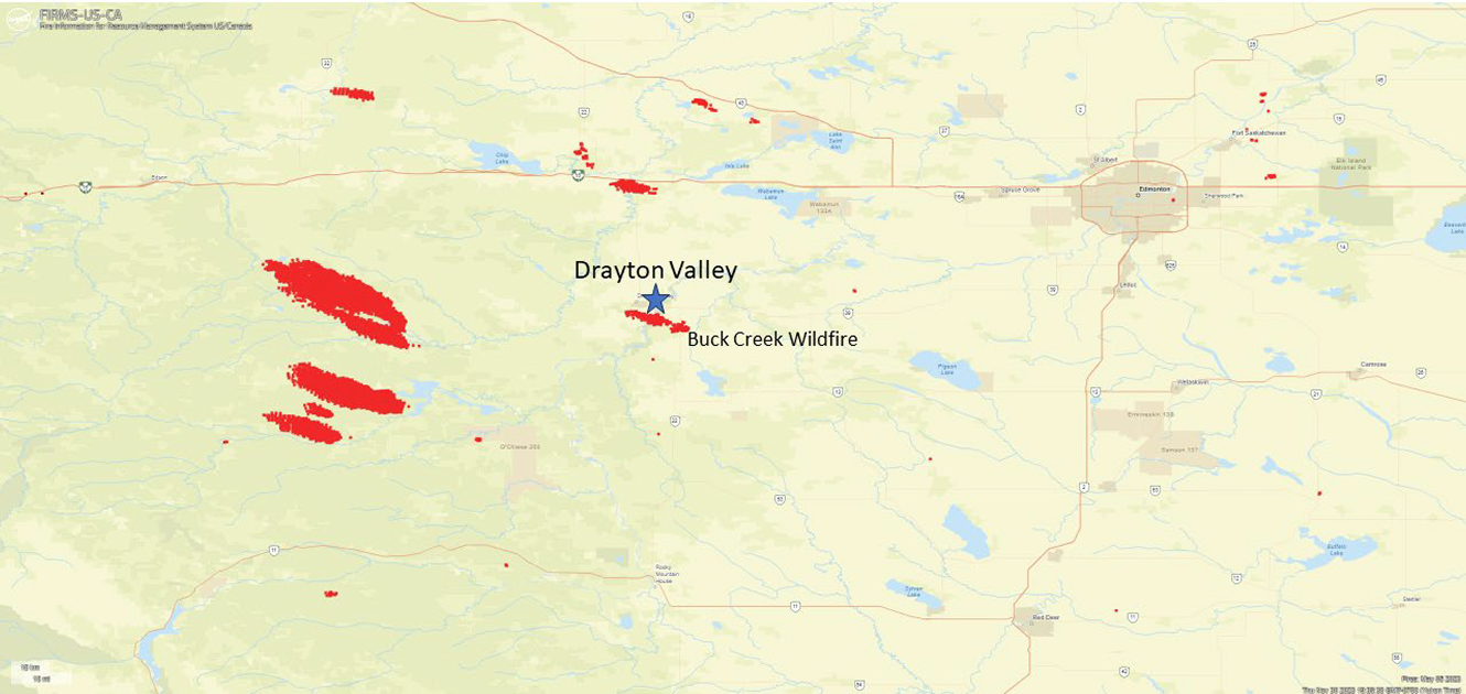
During the spring 2023 wildfire season Alberta was dealing with unmatched wildfire starts and growth. As Alberta was the first agency to experience multiple wildfire starts and aggressive wildfire growth that spring resources were available throughout Canada to assist. However, these resources would take 48 – 72 hours to arrive after requested. Due to the very rapid spread of the wildfires over a period of 24 hours, Alberta had to rely on its own wildfire management resources.
Incident Narrative
The Fire & Flood team response to the Buck Creek (RR64) Wildfire incident occurred over a period of 9 days from May 5 – May 14, 2023. The Buck Creek Wildfire initiated on May 3 in the Brazeau County approximately 7.5 km to the south and east of Drayton Valley. The wildfire proved problematic from the outset and grew quickly. This resulted in an evacuation order being established on May 3 at 17:37 by Brazeau County. This order was lifted at 10:30 on May 4 and re-established at 13:50. A State of Local Emergency was declared on May 4 at 16:30. The Buck Creek Wildfire continued to challenge the Brazeau County wildfire response team which resulted in the County dispatching Fire & Flood Emergency Services, Ltd. at 02:00 on May 5.
Alberta Wildfire was extremely busy prioritizing scarce resources with the many challenging wildfires that started that week throughout the province.
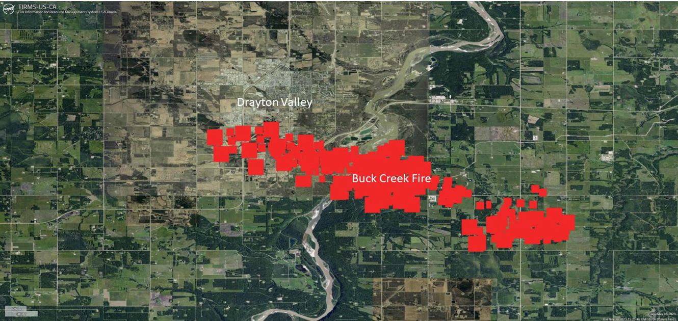
On May 5 at approximately 15:00 the Buck Creek wildfire reached the southern perimeter of Drayton Valley at Highway 22 (Figure 6).
Fire & Flood were involved in a number of key stages in the management of this wildfire. For the purposes of this case study, we will break the narrative into three phases. Table 1 provides a summary of key dates and times.
Table 1. Chronology of Events May 5 – 14, 2023
| Date/Time | Action |
|---|---|
| 05/05 02:00 | Fire & Flood receives dispatch request from Brazeau County |
| 05/05 04:00 | Two Person Advance Team arrive on site and complete a preliminary size up |
| 05/05 06:30 | Team Lead on site |
| 05/05 10:37 | Stage 1 – Water cannon line established on Highway 22 |
| 05/05 15:00 | Water cannon line pressurizing to boost pump 1, Cannons not operational at this time. |
| 05/05 15:00 | Wildfire runs to the north up to the stage 1 line with some spots over the highway. Spots contained and wildfire stopped from moving north into the town |
| 05/06 14:00 | Stage 2 – Water Cannon line extended west on Highway 22 to Highway 620. |
| 05/07 | Stage 3 – Water Cannon line extended south along Highway 620 and into key values within the wildfire perimeter |
| 05/07 | Water Cannon line challenged a second time with no spot fires over the line |
| 05/08 | Stage 4 – All main water cannon lines set up and interior values lines complete |
| 05/08 – 13 | Progressive mop up of hotspots within the wildfire perimeter |
| 05/14 | Fire & Flood demobilized and leave the site |
Organizational Phase: May 5th
The Fire & Flood team received the dispatch request at 02:00 on May 5,2023, from Brazeau County to provide structure protection resources to defend the community and outlying structure values from wildfire encroachment. The team quickly mobilized a two-person Advance Team to complete site assessment and organize the field response concurrent with the organization and transportation of equipment with the bulk of the personnel required. The Advanced Team was onsite within two hours of receiving the dispatch request.
By 06:30 on May 5th a team lead was onsite with an initial equipment order. The team lead met with onsite emergency managers, integrated with Incident Command and began installation of the first stage of a perimeter protection system.
Initial Response Phase: May 5 – 8
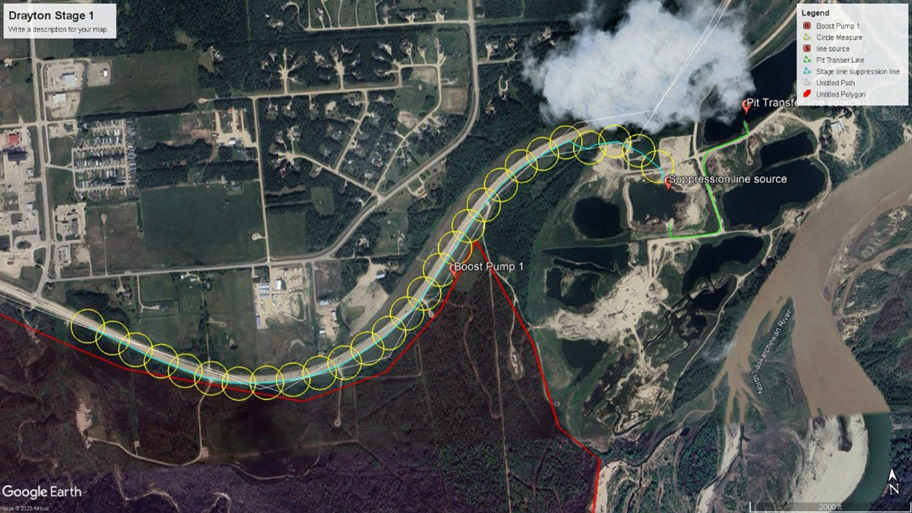
The installation of stage 1 of the perimeter protection system was complete by 10:37 on May 5 on the southeast corner of Drayton Valley along Highway 22 (Figure 7).
The following systems had been deployed as part of Stage 1:
- Two main pump and a boost pump supplying 2.7 km of 12-inch line with 27 water cannons along Highway 22.
- One 12-inch line pit transfer pump system to supply the main pit water source.
- Fill points for tenders and connection points for initial attack lines.
The wildfire weather forecast for May 5 was extreme with the Buck Creek wildfire expected to move aggressively towards the town from the Southeast. The perimeter protection system was not fully operational when the main front of the Buck Creek wildfire as it reached the southeast corner perimeter at approximately 15:00. A few spot fires crossed the perimeter protection line but were suppressed.
Expansion of the perimeter protection system continued with day and night shifts from May 5 through to May 14. On May 6, the Stage 1 line was extended to the corner of Highways 22 and 602 as part of Stage 2 (Figure 8).
The following components had been deployed as part of Stage 2:
- 1.2 km of 12-inch line with 13 water cannons along Highway 22.
- One 12-inch line pit transfer pump system to supply the main pit water source.
- Fill points for tenders and connection points for initial attack lines.
- Two 12-inch road crossings for emergency access/egress.

On May 7 the perimeter protection system was further expanded from the corner of Highways 22 and 602 south as part of Stage 3 (Figure 9).
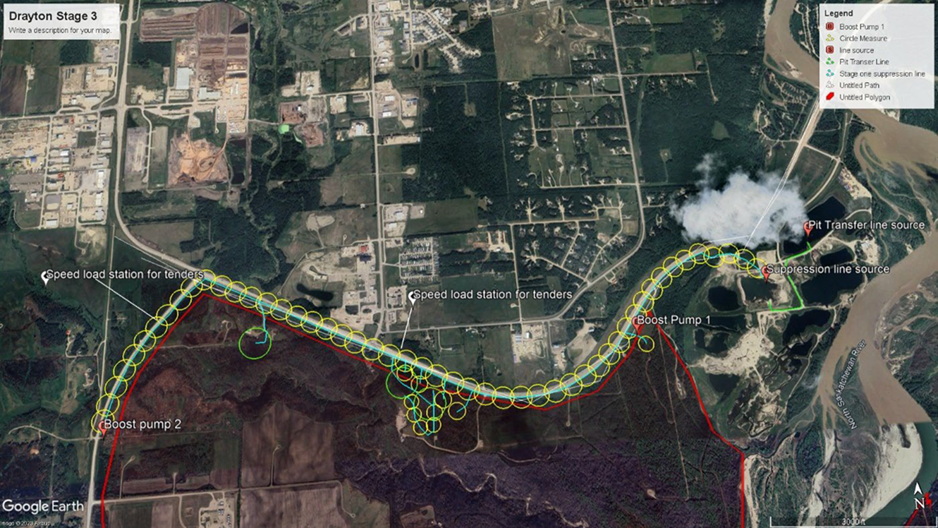
The following components had been deployed as part of Stage 3:
- 1.0 km of 12-inch line with 11 water cannons along Highway 602.
- Two additional Boost Pump.
- Branch lines into critical values south of the main perimeter protection line including a gas plant.
- Fill points for tenders and connection points for initial attack lines.
- Two additional 12-inch road crossings for access/egress.
The wildfire had another active day on May 7 and challenged the perimeter a second time with no spot fires across the line and no damage to critical values south of the perimeter.
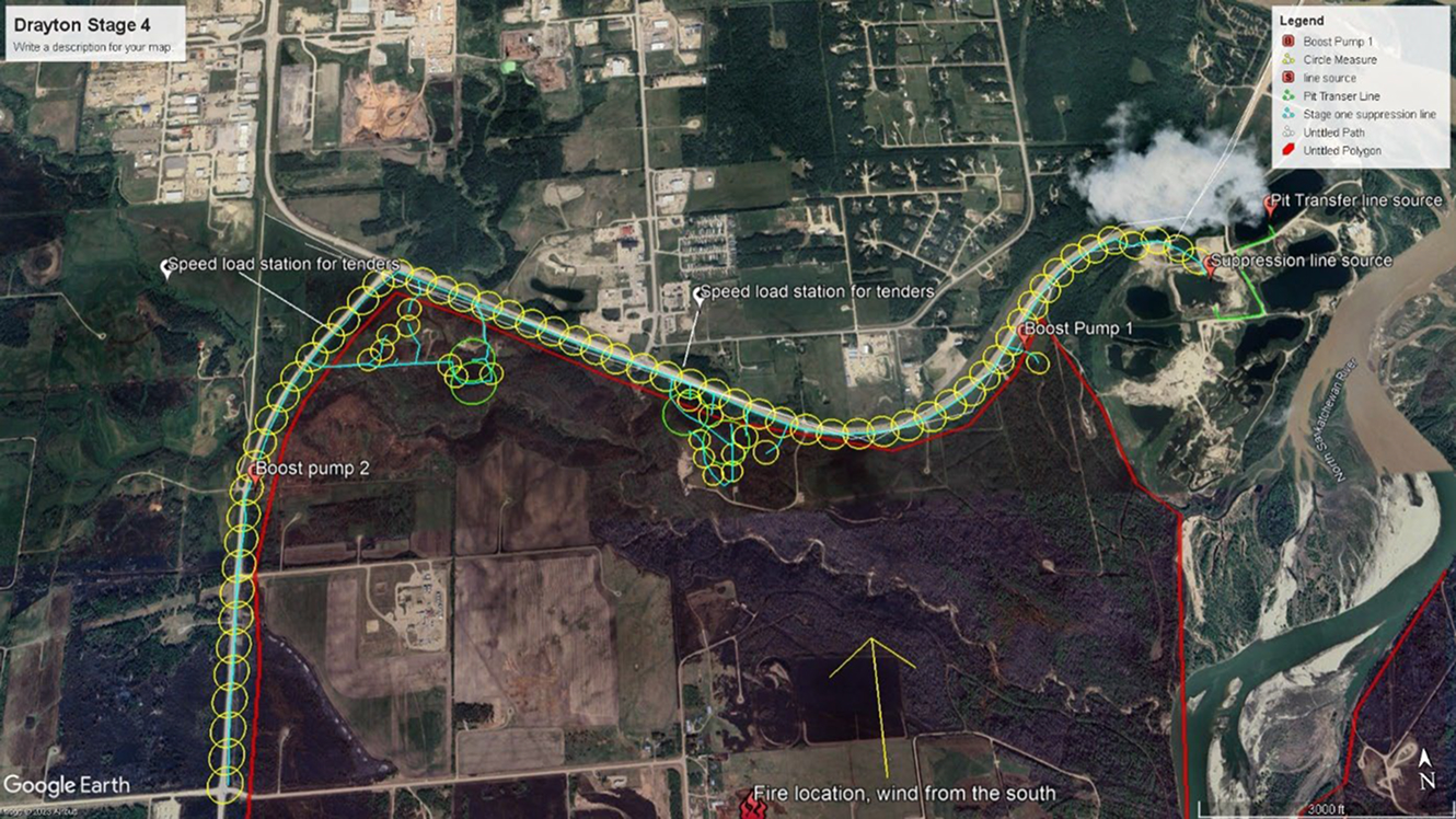
The initial response phase was completed by May 8 with the Highway 602 perimeter protection line extended south (Figure 10). When the entire perimeter protection line was completed, 126 hectares of perimeter was covered by the system.
The following components had been deployed as part of Stage 3:
- 1.0 km of 12-inch line with 12 water cannons along Highway 602
- Additional Branch lines into critical values south of the main perimeter protection line
- Fill points for tenders and connection points for initial attack lines
Progressive Suppression Phase: May 9 – 13
With the completion of the main perimeter protection line around the southern edge of Drayton Valley and two direct challenges to the line a weather change and suppression efforts allowed the Fire & Flood team to switch to direct suppression of wildfire line.
The main perimeter protection line was left in place while the Fire & Flood team supported the town fire department and Alberta Wildland Fire staff in extinguishing hot spots south of the perimeter within the wildfire. The extreme drought conditions and deep organic soils south of town resulted in depths of burn 2-3 meters deep over an extensive area. Over 100 hotspots were actioned using the high-volume system over 5 days.
While suppression was ongoing the Fire & Flood team assisted ATCO and FORTIS to restore electricity along burned over power lines.
By May 14, the Fire & Flood team had completed their assignment and met all objectives. The systems installed were extended, re-positioned and de-mobilized dynamically so that all equipment was used to maximize efficiencies. The systems were fully recovered and refurbished by May 14 and moved to their next assignment.
Discussion
The Buck Creek Wildfire incident in Brazeau County near Drayton Valley was a challenging deployment. Complications included aggressive fire behaviour driven by drought conditions and the spring dip in deciduous fuel types. These fire behaviour challenges were exacerbated by the significant wildfire situation that was ongoing in Alberta limiting resource availability. Finally, this wildfire with its aggressive behaviour and rapid growth was a challenge for County and Municipal resources who have limited experience managing such events.
We believe that this incident highlights the following elements of Fire & Floods response capabilities:
- Rapid self-contained response,
- Ability to operate with limited Command or fire behaviour specialist support,
- Responsiveness to changing demands,
- Ability to effectively provide progressive wildfire extinguishment. Each of these highlights is expanded upon below.
Rapid Self-Contained Response
The Fire & Flood team had leadership on site in Drayton Valley within two hours of the dispatch. It should be noted that there was Fire & Flood personnel in the vicinity related to other incidents, so they were able to provide immediate response. They had equipment and personnel onsite by 06:30 on May 5 which was 4.5 hours after the original dispatch call. Fire & Flood has a demonstrated capability to provide rapid response with both trained personnel and equipment.\
Ability to operate with limited Command or Fire Behaviour Support
Outside of the Forest Protection Areas in Alberta, the responsibility to respond to wildfire rests with local governments including Counties and Municipalities. The operational responsibility for response most often falls to County and Municipal Fire Departments. On significant incidents, support is often sought from Alberta Wildfire which is the provincial agency with responsibility for wildfire management in the Forest Protection Areas. In times of normal wildfire load this support is usually available but in times of heavy wildfire load or on a rapidly evolving situations this support may not be available. Wildland fire experience varies among fire departments. Aggressive rapidly spreading wildfires are a challenge for the most experienced dedicated wildland fire management agencies and can quickly expose gaps in response from lesser experienced agencies. Through the initial phases of this incident the Fire & Flood team found themselves operating in a situation where they were providing the senior fire behaviour and command experience. This placed Fire and Flood in a position where they were providing the direction to set priorities, objectives and to determine safety factors. As the incident evolved and additional personnel arrived, the reliance on Fire & Flood to play these roles was reduced.
The team has developed a highly capable roster through hiring, training and experience that can work through these types of scenarios to successful outcomes. They not only have the experience to manage the complex water delivery and associated infrastructure they also have a depth of command and wildland fire behaviour experience required for positive outcomes.
Responsiveness to changing demands.
The response to this incident saw the Fire & Flood team demonstrate an ability to adapt to evolving situations. Throughout the entire incident, the team ran both a day and night shift. The night shift was required for a variety of reasons including maintaining existing systems and lines, receiving, and staging new equipment as well as the patrol of existing lines. The night shift often pre-staged equipment so that day operations were more effective. Night operations add layers of complexity in terms of logistics and safety. The capacity to support night shifts over a longer period significantly improves the effectiveness of operational systems. In this case it supported the delivery of greater volumes of water to continuously extended areas for suppression.
Another area that the team showed their ability to be responsive to changing demands was their frequent adjustments to water output to enable operations for other key stakeholders. Both ATCO and FORTIS, who provide electrical services within the province, had infrastructure that was impacted by the wildfire. The Fire & Flood team was able to adjust operations to support both the utility companies in their efforts to reestablish electrical utility services. They did this by working in conjunction with the companies to adjust where and when they were operating their water delivery systems according to where the companies were working. This resulted in the team constantly adjusting operations to enable critical infrastructure repair work. The system was not static during the incident but was constantly being adjusted to meet changing operational requirements.
The team also adjusted to work with Fire Departments and wildfire crews by supplying them with water for tenders, engines and in some cases direct suppression. The photo on the cover page of this report illustrates a water tender speed filling station. These are an important element on a large operation as they enable the rapid movement of water to remote areas of the incident. The Fire & Flood systems are designed to maximize capability by coming equipped to interface with a wide range of wildfire and structural fire apparatus. This ability makes the Fire & Flood systems more valuable to an incident as they can better enable other resources to operate effectively.
Ability to effectively provide progressive wildfire extinguishment.
The Fire & Flood systems are often utilized in wildfire scenarios for values protection at or near the location of structure values. While they have proven very effective in these instances the systems also have broader value in direct attack scenarios. On the Buck Creek Wildfire the Fire & Flood systems were used to progressively extinguish smouldering fires (mop up) from the fire perimeter into the interior of the wildfire. These systems were able to distribute large volumes of water over large areas. When drought conditions and fuel types create large areas of deep burning fuels such as that experienced on the Buck Creek Wildfire, high volume systems such as those Fire & Flood can be very effective. The Fire & Flood team with their demonstrated ability to rapidly deploy-recover-redeploy have created a tool that is particularly useful in this instance. With their integrated systems of high-volume pumps and lines to progressively smaller lines the team can deploy very large volumes of water over large areas.
It is difficult to directly compare this technique to more traditional techniques which would involve personnel on the ground utilizing 1.5-inch hose from either standing or mobile water sources in mop up. This technique is very effective when the problem areas or hot spots are spread out and limited.
However, when deep ground fire in drought conditions is experienced, this technique is very laborious and time consuming. In addition, the technique exposes personnel to risk as they must spend significant time on the ground in deeply burned fuels. Utilizing high volume systems to complete this work in deep burning conditions limits exposure for personnel as once the lines are established the water does the work.
Two examples from the incident are notable the first involved a 27 hectare area in the northwest corner of the Fire & Flood line. The area contained an estimated 100+ hot spots and was virtually a continuous ground fire. The team utilized 2 large cannons and 8 small cannons over three days extinguished the wildfire hotspots within that perimeter. A structural fire crew onsite estimated that would have taken their 6–8-person crew 3 weeks. Another relevant example was the extinguishment of 126 ha of area covered by the primary line that wrapped around the north and west perimeters of the flank the team was responsible for. This portion of the wildfire perimeter was extinguished over a 3-day period.
The use of the Fire & Flood systems to efficiently extinguish hot spots freed up wildfire management staff to focus on other parts of the wildfire and help deal with the many other challenging wildfires in the region.
This incident provided an excellent opportunity to demonstrate the effectiveness of the high-volume systems deployed by the Fire & Flood team for anchor point, containment and mop up operations in high drought code conditions. The improved safety margin associated with these systems makes it work considering broader use of this strategy. A cost-benefit analysis would be useful to more fully evaluate the value of this strategy.
Conclusion
The Buck Creek Wildfire presented several significant challenges to suppression related to the extreme drought conditions and the spring dip. The Fire & Flood equipment provided distinctive solutions to the fire behaviour issues that arose. The team demonstrated their ability to contribute significantly during initial wildfire runs early in the incident. Fire & Flood played key roles in the areas of the fire they were assigned to including providing strong command support and fire behaviour expertise. As the incident progressed, they were able to demonstrate that their systems had the flexibility to play multiple roles on the incident. Their systems effectively supported other responders and stakeholders. Finally, Fire & Flood demonstrated that their systems have some currently under-utilized capability related to progressive wildfire extinguishment in deep burning continuous fuel beds.
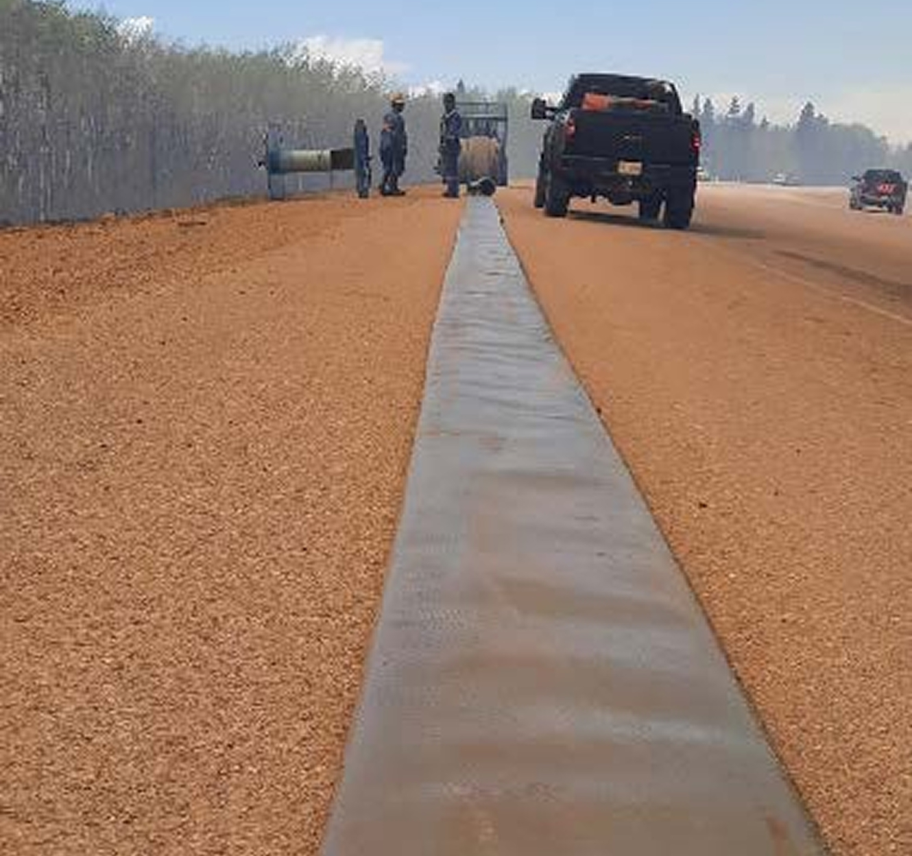
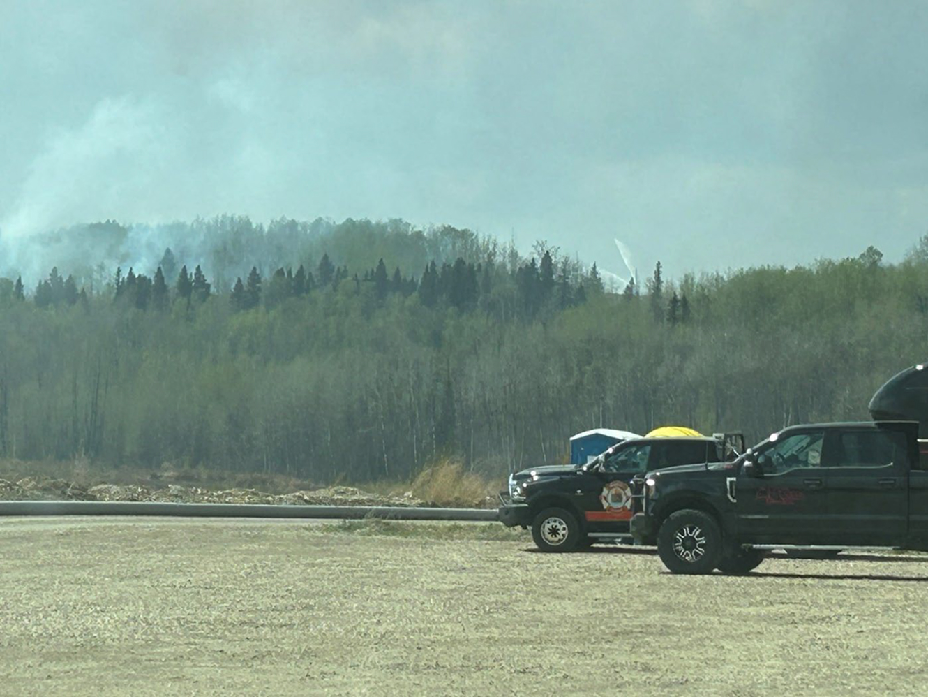
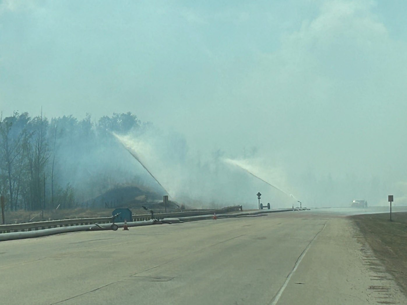
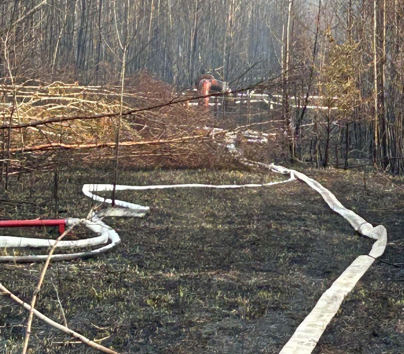
Appendix 1: Photos from the Fort Smith Deployment




Wildland Fire Works Consultants who authored this report were:
Mike Etches – Forty years of experience in managing wildland fires at the crew, Duty Officer, Incident Management Teams and executive management levels. Mike’s focus includes tactical and strategic planning, the Planning Section Chief function and Team Development
Rick Kubian – Forty years of experience in managing landscape wildland fires in protected areas, prescribed fire, Duty Officer. Incident Management teams and executive Management. Rick’s focus includes tactical and strategic planning, the Incident Command function and Team Development.
The contents of this report are the intellectual property of Wildland Fire Works. You may not reuse, republish, or reprint such content without our prior written consent.
All information provided is for informational purposes. Should you decide to act upon the information in this report, you do so at your own risk.
While the information in this report has been verified to the best of our abilities, we cannot guarantee that there are no mistakes or errors.

